Entering Öland:
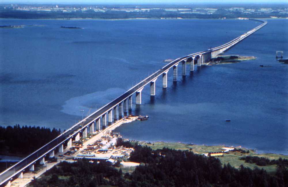 We took a bus from
Stockholm's central station to Kalmar on the mainland and then
rejoined our hosts Lotta and Bo for a visit to the island of Öland,
where they have a holiday house. Access to the island is via
the bridge shown in the photo to the left. The Öland Bridge
(Ölandsbron) connects Kalmar to Färjestaden on the island of
Öland to its east. At 6,072 meters (19,921 ft) long, it is one
of the longest in Europe. It is supported by 156
pillars, and has a characteristic hump at its western end
which was created to provide a vertical clearance of 36 m for
shipping. An impressive sight and a stylish way to enter Färjestaden.
We took a bus from
Stockholm's central station to Kalmar on the mainland and then
rejoined our hosts Lotta and Bo for a visit to the island of Öland,
where they have a holiday house. Access to the island is via
the bridge shown in the photo to the left. The Öland Bridge
(Ölandsbron) connects Kalmar to Färjestaden on the island of
Öland to its east. At 6,072 meters (19,921 ft) long, it is one
of the longest in Europe. It is supported by 156
pillars, and has a characteristic hump at its western end
which was created to provide a vertical clearance of 36 m for
shipping. An impressive sight and a stylish way to enter Färjestaden.Färjestaden Hamn:

 Färjestaden Hamn is the
harbor on Öland that is directly across
from Kalmar, and those not wishing to take the bridge across
may do so from the mainland to this harbor. On weekends it is
the site of a large market, which we visited with our hosts on
the last day of our stay. The photo to the left shows a map of
the harbor area, while the photo to the right offers a glimpse
of the harbor. Visible in the photo is the ferry from Kalmar
to Färjestaden.
Färjestaden Hamn is the
harbor on Öland that is directly across
from Kalmar, and those not wishing to take the bridge across
may do so from the mainland to this harbor. On weekends it is
the site of a large market, which we visited with our hosts on
the last day of our stay. The photo to the left shows a map of
the harbor area, while the photo to the right offers a glimpse
of the harbor. Visible in the photo is the ferry from Kalmar
to Färjestaden.Our Trip Through South Öland:
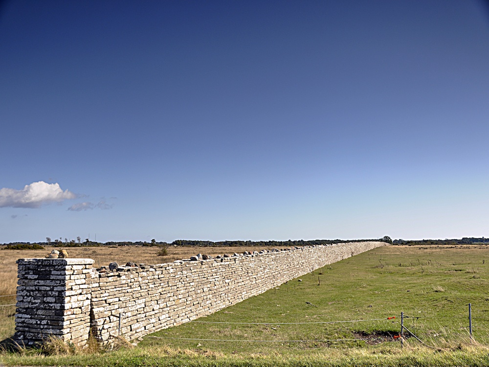
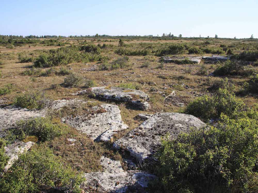
Given the constraints of time and logistics, our visit was focused on Södra Öland or the southern portion of the island. It is a summer holiday spot and the population dwindles drastically in the winter months. Bo and Dale took a day trip across the south, beginning at the southernmost tip.
Långe Jan:
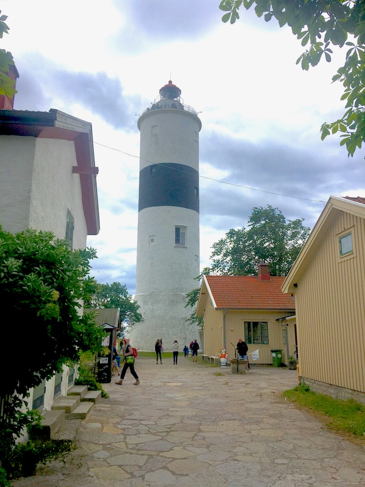 Långe Jan ("Tall John") is a
Swedish lighthouse located at the south cape of Öland in the
Baltic Sea. It is a companion lighthouse to Erik, located at
the northern end of the island. The lighthouse was built in
1785, by Russian prisoners of war. The tower was built of
stone from an old chapel. Originally the light was an open
fire, and the tower was unpainted. It was painted white in
1845, and the same year the tower's lantern was installed, a
colza oil lamp. A couple of years later a black band was added
to the tower. The lighthouse remains in use and is
remote-controlled by the Swedish Maritime Administration in
Norrköping. During the summer season it is possible to climb
the tower, for a small fee. The buildings surrounding the
tower form the Ottenby birding station.Worth
visiting is the Naturum, a small building containing dioramas
and information about the birds that can be seen here. Just
below the lighthouse is a Vindskyddet or lean-to, a shelter
from which you may watch the birds or the seals sunning
themselves (when possible) on the rocky beach. These are shown
in the panorama below.
Långe Jan ("Tall John") is a
Swedish lighthouse located at the south cape of Öland in the
Baltic Sea. It is a companion lighthouse to Erik, located at
the northern end of the island. The lighthouse was built in
1785, by Russian prisoners of war. The tower was built of
stone from an old chapel. Originally the light was an open
fire, and the tower was unpainted. It was painted white in
1845, and the same year the tower's lantern was installed, a
colza oil lamp. A couple of years later a black band was added
to the tower. The lighthouse remains in use and is
remote-controlled by the Swedish Maritime Administration in
Norrköping. During the summer season it is possible to climb
the tower, for a small fee. The buildings surrounding the
tower form the Ottenby birding station.Worth
visiting is the Naturum, a small building containing dioramas
and information about the birds that can be seen here. Just
below the lighthouse is a Vindskyddet or lean-to, a shelter
from which you may watch the birds or the seals sunning
themselves (when possible) on the rocky beach. These are shown
in the panorama below.Långe Jan and Ottenby Birding Center
 There is also
a version of this tour designed
specifically for VR headsets such as
Google Cardboard, and it works with both
iPhone and Android devices. It may be
access by scanning on the QR code to the
left. If you are viewing this on a mobile
phone, you may access the VR tour by
following this
link.
There is also
a version of this tour designed
specifically for VR headsets such as
Google Cardboard, and it works with both
iPhone and Android devices. It may be
access by scanning on the QR code to the
left. If you are viewing this on a mobile
phone, you may access the VR tour by
following this
link.
For iOS devices: scan QR code with your
device's camera app, tap on the prompt to open Safari.
Select "Allow Device Motion" and the next prompt,
"Allow Access to Motion Orientation." Turn the device
to landscape mode and a split screen will appear. When
the screen turns white, swipe up for fullscreen mode,
and place in headset. Here
is a video of how to do this--it is simpler
than it sounds! [The video opens in a new
window--close when done to return to this page]

 There is
also a version of this tour designed
specifically for VR headsets such as Google
Cardboard, and it works with both iPhone and
Android devices. It may be access by scanning
on the QR code to the left. If you are viewing
this on a mobile phone, you may access the VR
tour by following
There is
also a version of this tour designed
specifically for VR headsets such as Google
Cardboard, and it works with both iPhone and
Android devices. It may be access by scanning
on the QR code to the left. If you are viewing
this on a mobile phone, you may access the VR
tour by following